
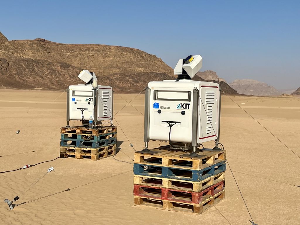
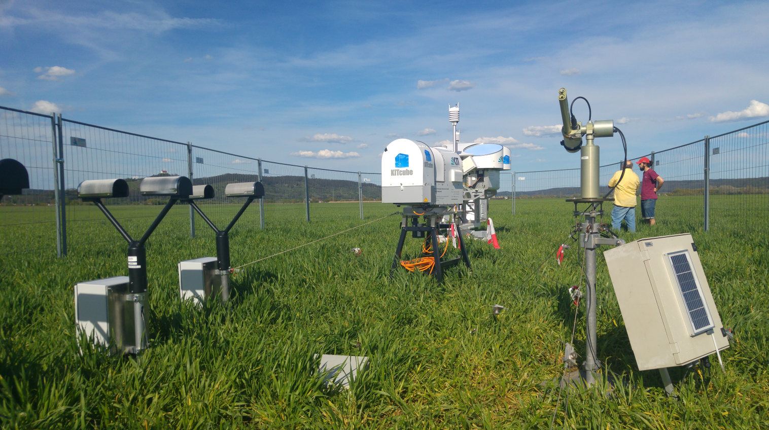
Messkampagnen
Der mobile KITcube wird regelmäßig für integrierte Messkampagnen weltweit eingesetzt. Die meisten Kampagnen werden in Zusammenarbeit mit Partnerinstitutionen durchgeführt und untersuchen verschiedene aktuelle Forschungsbereiche. Die Themen reichen von der Verbesserung des Verständnisses hydrologischer Kreisläufe und Herausforderungen im Zusammenhang mit der globalen Erwärmung, lokalen konvektiven Zellen und extremen Winden über die Validierung regionaler Klimamodelle bis hin zu interdisziplinären Projekten, welche die Auswirkungen des explosiven Bevölkerungswachstums, der Urbanisierung und des Wirtschaftswachstums auf Atemwegserkrankungen, die Landwirtschaft und die Wolken- und Niederschlagsbildung während des westafrikanischen Sommermonsuns untersuchen. Zu diesem Zweck wird der KITcube an verschiedenen Orten und Kontinenten weltweit eingesetzt.
![]() NAWDIC (2025/26)
NAWDIC (2025/26)
NAWDIC ist eine neue Initiative für eine internationale Messkampagne welche sich auf atmosphärische Dynamik in den mittleren Breiten konzentriert. Detaillierte Beobachtungen der mesoskaligen Tropopausenstruktur, der Wechselwirkung zwischen dem trockenen Intrusionsluftstrom und des PBL und deren Auswirkungen auf das Wetter im Nordatlantik, speziell in den Wintermonaten, sollen zur Verbesserung des Verständnisses und der verbesserten Modellierung dieser Dynamiken beitragen. NAWDIC besteht aus mehreren Komponenten, die als eigenständige Messkampagnen von verschiedenen Gruppen geplant werden, und gleichzeitig von Synergien unter dem Dach von NAWDIC profitieren.
|
|
|
![]() TEAMx (2025)
TEAMx (2025)
Atmosphärische Prozesse, welche häufig spezifisch für Gebirgsregionen sind, beeinflussen den Austausch von Impuls, Wärme und Masse zwischen der Erdoberfläche und der Atmosphäre. TEAMx ist ein internationales Forschungsprogramm das darauf abzielt unser Verständnis dieser Prozesse zu verbessern. Die Feldkampagne wird sich auf die europäischen Alpen konzentrieren, wobei mikrometeorologische Instrumente, bodengestützte Profilmessgeräte und flugzeuggestützte Sensoren in großem Umfang eingesetzt werden.

|
|
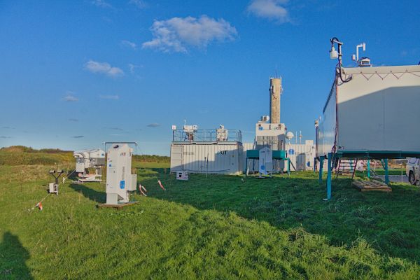
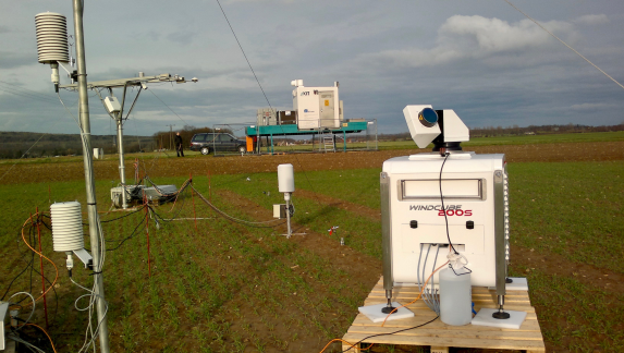
![]() Swabian MOSES 2.0 + Lift (2023)
Swabian MOSES 2.0 + Lift (2023)
Die Kampagne Swabian MOSES 2.0 findet im Rahmen des MOSES-Beobachtungssystems der Helmholtz-Gemeinschaft statt. Dieses besteht aus verschiedenen Modulen, welche insbesondere die Wechselwirkungen zwischen kurzfristigen Ereignissen und langfristigen Trends in verschiedenen Komponenten des Erdsystems zu untersuchen. Der genaue Schwerpunkt der Kampagne lag auf der Entwicklung von Gewittern, Starkregen und Hagel.
 |
 |
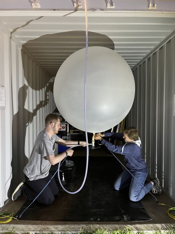 |
J-WADI J-WADI (2022)
Im September 2022 wurde im Süden Jordaniens eine umfassende Messkampagne über Mineralstaub durchgeführt werden. Ziel ist es die Partikelgröße einschließlich riesiger Mineralstaubpartikel und die mineralogische Zusammensetzung des emittierten Staubs sowie deren Abhängigkeit von der emittierenden Oberfläche und den meteorologischen Bedingungen besser zu verstehen. Das Verständnis des Emissionsprozesses von Mineralstaub ist eine wichtige Voraussetzung für die Quantifizierung der regionalen und globalen Auswirkungen von Staub auf Luftqualität, Gesundheit, Wirtschaft und nicht zuletzt auf Wetter und Klima. Die Kampagne wird gemeinsam von der Helmholtz-Nachwuchsgruppe "Mineralstaub" am KIT IMK-TRO (PI M. Klose) und dem ERC Consolidator Grant "FRAGMENT" am Barcelona Supercomputing Center (PI C. Pérez García-Pando) unter Beteiligung mehrerer weiterer Forschungsinstitute organisiert, z. B. der University of Jordan (Jordanien), der TU Darmstadt (Deutschland), IDAEA-CSIC (Spanien), INRAE (Frankreich), DRI (USA).
 |
 |
![]() TEAMx PreExperiment (2022)
TEAMx PreExperiment (2022)
In Vorbereitung der TEAMx-Messkampagne 2024 wurden über den Sommer 2022 vier DopplerLIDAR Systeme, sowie das Dual Frequency FMCW Wolkenradar im Inntaal betrieben um lokale Strömungseigenschaften beobachten zu können und die Messstrategie zu überprüfen und optimieren.
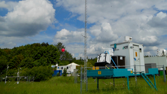
![]() Swabian MOSES (2021)
Swabian MOSES (2021)
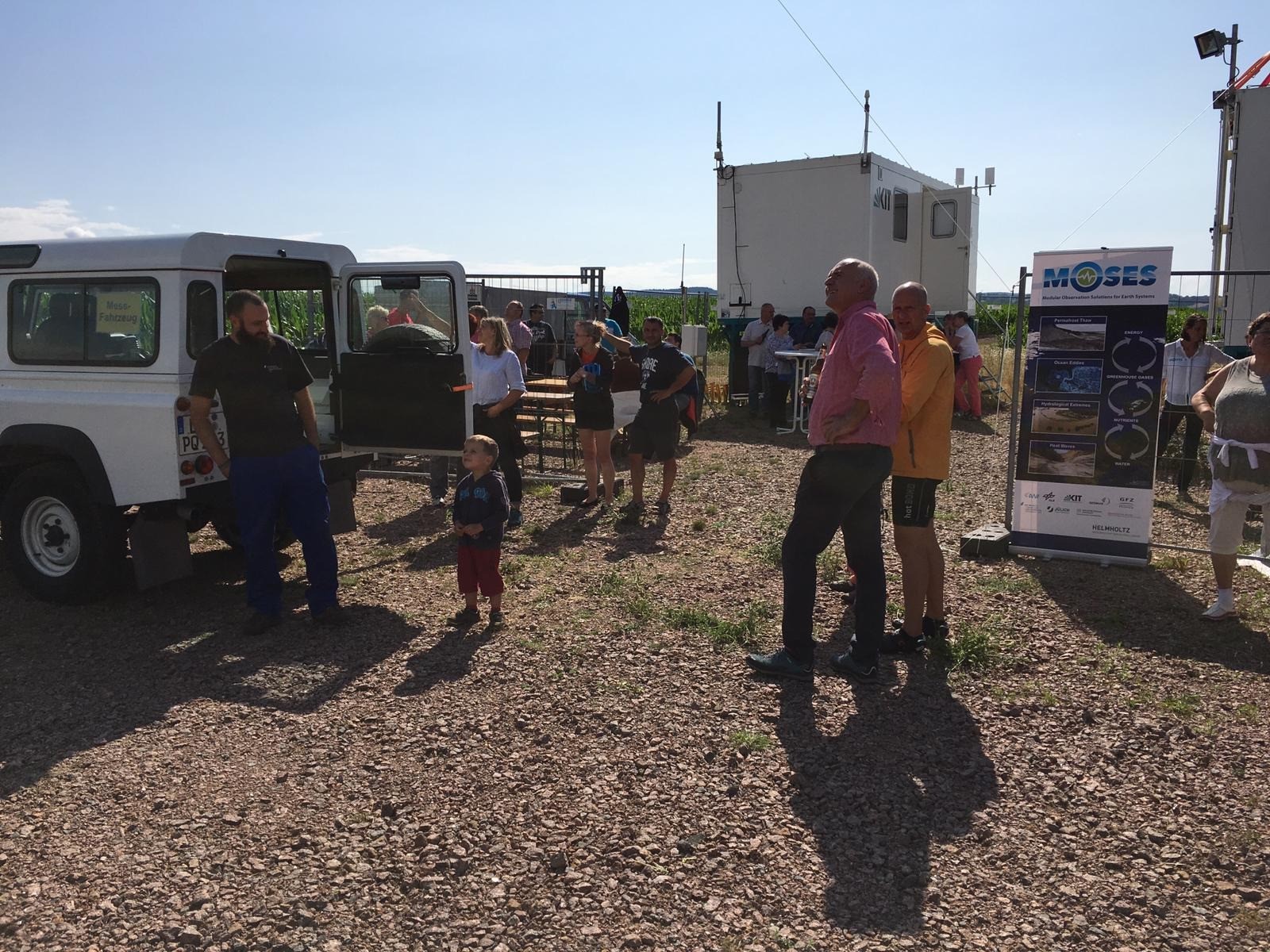
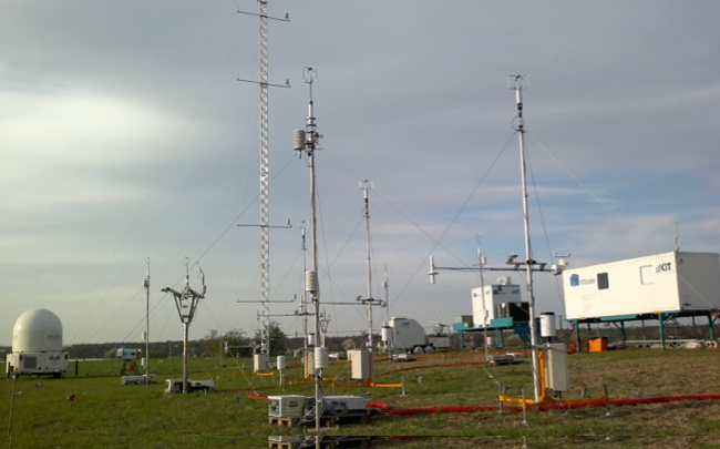
Die MOSES Messkampagne Swabian MOSES startete am 04.05.2021. Swabian MOSES ist eine hydrometeorologische Messkampagne, die zwischen Mai und September 2021 im Neckartal und auf der Schwäbischen Alb im Südwesten Deutschlands durchgeführt wurde. Der Fokus lag auf zwei hydrometeorologische Extreme, die nicht nur für das Untersuchungsgebiet von großer Relevanz sind, sondern auch für lokalräumige konvektiven Zellen (Gewitter) in Verbindung mit Starkregen und Hagel, sowie großräumige Hitzewellen und die damit verbundenen Dürren.
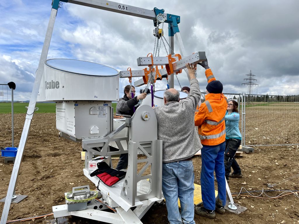
Die Swabian MOSES Kampagne - koordiniert vom IMK-TRO - ist ein Gemeinschaftsprojekt von 9 Institutionen: Helmholtz Zentren KIT, GFZ, UFZ, FZJ, sowie die Eberhard Karls Universität Tübingen, Universität Hohenheim, Technische Universität Braunschweig (TU), Deutscher Wetterdienst (DWD) und Deutsches Zentrum für Luft- und Raumfahrt (DLR). Die KITcube Hauptstandorte befanden sich in Rottenburg am Neckar und Nürtingen (X-Band Radar) im Neckartal (siehe Bilder).
 |
 |
Die mobilen KITcube Hauptstandorte Rottenburg am Neckar (links) und Nürtingen (rechts) während der Swabian MOSES Kampagne 2021 im Neckartal und auf der Schwäbischen Alb im Südwesten Deutschlands. Links: KITcube Distrometer (l), Photometer (r), Mikrowellenradiometer, das neue FMCW Wolkenradar (m) und ein Doppler Lidar (nicht sichtbar). Rechts: Installation des KITcube X-Band Radar in Nürtingen am 19 April 2021.
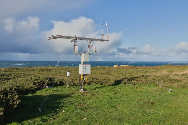
CROSSINN (2019)
Anfang Juli startete der Einsatz von KITcube für die CROSSINN-Kampagne. Um talübergreifende Strömungsregime zu untersuchen, wurden die Leosphere WLS200s Doppler-Lidare an zwei gegenüberliegenden Hängen des alpinen Inntals in Österreich installiert und ist durch direkter Link Telemetrie mit dem WLS200s verbunden, welches sich am Hauptstandort im Talboden für Echtzeit-Instrumentensteuerung, koordiniertes Scannen und Datenübertragung genutzt wurde. Weitere wichtige Instrumente in dieser Kampagne sind das Radiometer HATPRO G4, das Ceilometer CHM15k, Radiosonden und das damals neue 4-Sensor-Vis/IR-Wolkenkamerasystem.
 |
 |
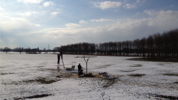
![]() MOSES Müglitz (2019).
MOSES Müglitz (2019).
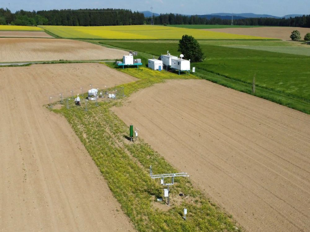
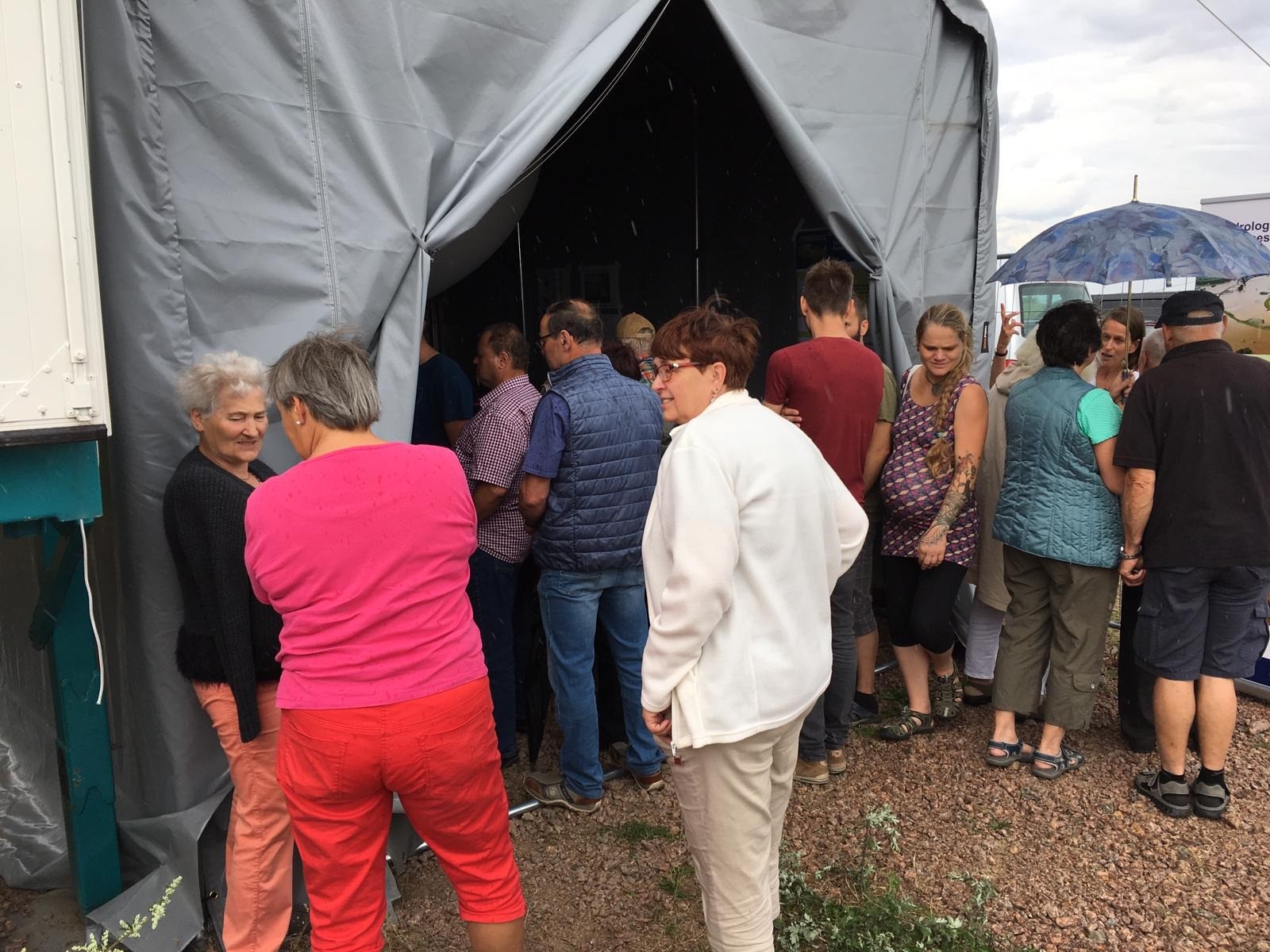
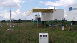
Im Rahmen des Helmholtz Projekts MOSES (Modular Observation Solutions for Earth Systems) beteiligt sich das IMK-TRO an der Wirkungskette "Hydrologische Extreme" und koordinierte die Messkampagne Müglitz 2019 welche von Mai bis Juli 2019 im Osterzgebirge (Sachsen) stattfand. Zusammen mit den MOSES Partnern GFZ, UFZ, und FZJ wurden während 6 Intensivmessphasen Starkniederschläge von ihrer Entstehung bis hin zu deren Auswirkungen untersucht. Dabei traten sowohl mehrtägiger Dauerregen als auch Starkregen durch hochreichende Konvektion auf.
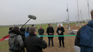
Die Messkampange wurde unter regem öffentlichen Interesse mit einem Tag der offenen Tür am 21.07.2019 am KITcube Hauptmessplatz in Dittersdorf beendet.
 |
 |
 |
 |
KITcube Hauptstandort während der MOSES Kampagne 2019 in Dittersdorf, Ostergebirge, Saxony. Oben links: Aufbau und Installation des KITcube im späten April, oben rechts: Gewitterereignis mit starken Niederschlag und Hagel vom 12 Juni, unteren Bilder: Tag der offenen Tür am Ende der 2019 Kampagne am 21 Juli.
 NaFoLiCA (2017)
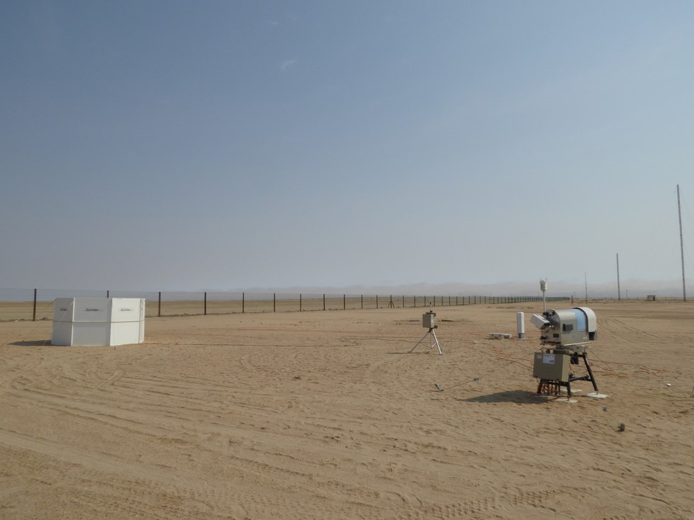
2017 wurde das modulare Konzept des mobilen KITcube für gleichzeitige Messungen in Namibia und Deutschland voll ausgenutzt.
Namib Fog Life Cycle Analysis – NaFoLiCA
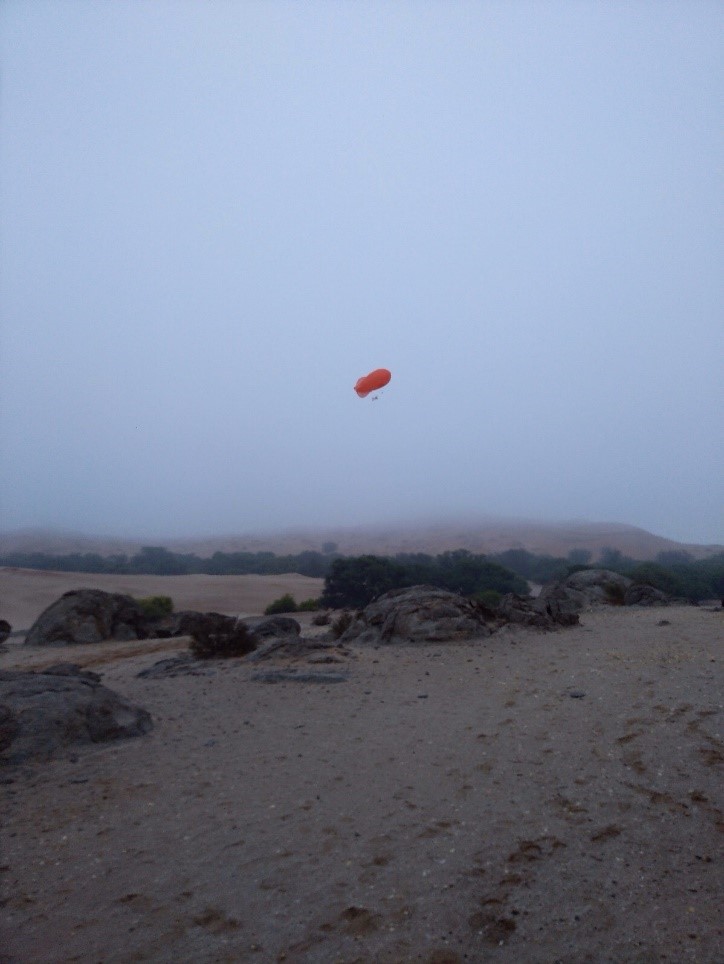
Für die Namib-Wüste, eine der trockensten Regionen der Erde, ist Nebel eine wichtige Wasserquelle und beeinflusst die räumliche Verteilung von Flora und Fauna. Das Wissen über die räumlichen und zeitlichen Muster der Nebelverteilung ist unvollständig und insbesondere die Menge der Nebelwasserablagerung ist unbekannt. Das Ziel der Namib Fog Cycle Analysis (NaFoLiCA) ist es, das Verständnis der Nebeldynamik in der Region zu verbessern. Teile des KITcube wurden im September und Oktober 2017 in Namibia betrieben.
 |
 |
|
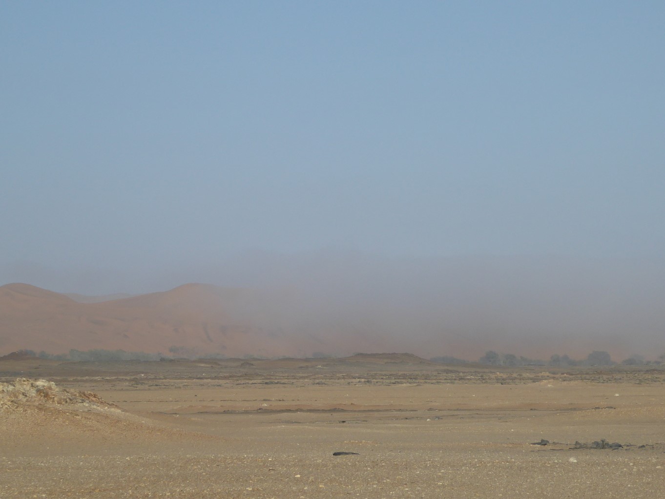
Left: Ein Sodar (im Hintergund, links), ein Aerosolspektrometer (im Hintergrund, mittig) und ein Mikrowellenradiometer (im Vordergrund) liefern Wind-, Temperatur-, Feuchtigkeits- und Aerosolbeobachtungen am Coastal Met (in der Nähe von Walvis Bay, etwa 10 km östlich des Atlantiks). Right: Nebelgrenze zwischen der Küste und Gobabeb
|
|
 |
 |
|
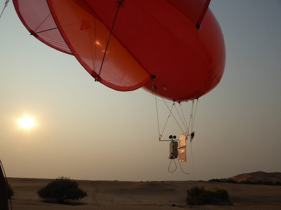
Fesselballonaufstiege am Gobabeb Forschungs- und Ausbildungszentrum etwa 55 km östlich des Atlantiks. |
|
![]() [UC]2 - Urban Climate Under Change (2017-2018)
[UC]2 - Urban Climate Under Change (2017-2018)
The program “Urban Climate Under Change - [UC]²" aims at the development, validation and application of building-resolving urban climate models for entire cities. Within joint research projects ‚Three-dimensional Observation of Atmospheric Processes in Cities (3DO) “High-resolution urban wind fields and city-surroundings exchange processes” are investigated to improve understanding of the following items: (a) horizontal structure of intra-urban horizontal wind field patterns, (b) vertical structure of Urban Boundary Layers (UBLs), (c) superimposed secondary circulation systems, (d) exchange between the UBL and the lower free troposphere with respect to momentum, heat, humidity and atmospheric pollutants and (e) provision of respective evaluation data for urban climate models. KITcube continuous measurements are taking place in the city of Stuttgart in 2017 and 2018 including 2-month duration intensive observation periods during winter and summer each year. Measurements in Stuttgart within the BMBF Program Urban Climate Under Change [UC]² are ongoing in 2018.
 |
 |
 |
 |
|
HATPRO microwave temperature and humidity profiler (top left) and Windcube Doppler-lidar (top right) in Stuttgart city centre on top of the town hall. Two WindTracer Doppler lidar systems were installed in the vineyards of Stuttgart for coordinated dual Doppler operation (bottom left + right), together with the X-Band radar (bottom right) to study local flow systems, and modifications of precipitation patterns by urban areas. |
|
WASTEX WASTEX - Wind And Storm Experiment (2017)
Wind gusts are responsible for most of the damages in cyclonic winter storms, the most destructive natural hazards over central Europe. Their forecast is challenging, because they involve multiple scales from the track and intensity of the storms down to turbulent momentum transport. Observations and forecasts are investigated here to gain an insight into the dynamics and predictability of gusts at subsynoptic scales. The field campaign WASTEX (Wind And STorms EXperiment) within the DFG Transregio 165 “Waves2Weather” framework was conducted during winter 2016/17 near the city of Karlsruhe.
The WindTracer HYB Doppler lidar and a MFAS sodar provided high-resolution observations in space and time within a range of several km during the passage of low-pressure systems.
 |
 |
WindTracer HYB Doppler lidar and MFAS sodar during WASTEX on top of a small hill “Energieberg” in the western part of Karlsruhe waiting for the next storm event.
![]() DACCIWA (2016)
DACCIWA (2016)
Dynamics-Aerosol-Chemistry-Cloud Interactions in West Africa - DACCIWA
Goal of the interdisciplinary DACCIWA project is to investigate the influence of the rapid increase of air pollution associated with explosive population growth, urbanisation und economic growth on respiratory diseases, agriculture, and cloud and precipitation formation during the West African summer monsoon. So far, the influence of manmade pollution on weather and climate is unknown due to a lack of observations and process understanding. DACCIWA aims to close this gap by gathering invaluable data during a large field and aircraft campaign in summer 2016, which will help to improve our understanding in aerosol-chemistry-cloud-precipitation formation and its representation in weather-chemistry models.
KITcube was deployed to Savè in Benin to conduct measurements during the monsoon period in June and July. The site was operated jointly together with our partners of University of Toulouse with main focus of on identification of meteorological controls on the whole process chain from the formation of nocturnal stratus clouds, via the daytime transition to convective cloud, and the formation of deep precipitating clouds. KITcube infrastructure was the base for interconnecting instruments, exchanging data and communication at the measurement site.
During the campaign, the first time cloud and aerosol profiles were derived from KITcube measurements applying the cloudnet program suite directly on site. We gratefully thank Ewan O’Connor!
Two movies – one realized by the film teams of KIT and University of Toulouse https://www.youtube.com/watch?v=zjDrEvTmZt8 and another by Arnauld Mansat https://vimeo.com/184522021 illustrates the scientific work and logistic challenges of such a field campaign.
 |
 |
 |
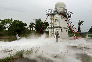 |
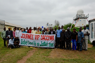
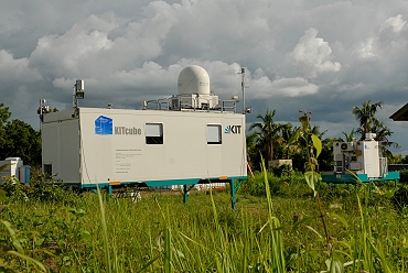
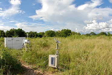
VIP day at the Savè measurement site with guest from Ministries, Research Institutions, Weather services and local administration (top left). KITcube office container with connected cloud radar, X-Band radar, Doppler lidars and cloud cameras (top right), sodar, microwave profiler and Aeronet photometer (lower left) and during a flow visualization experiment next to the X-Band radar (lower right).
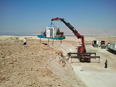
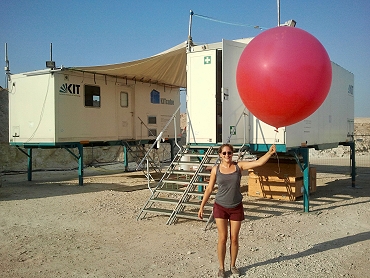
![]() DESERVE (2014)
DESERVE (2014)
Dead Sea Research Venue - DESERVE
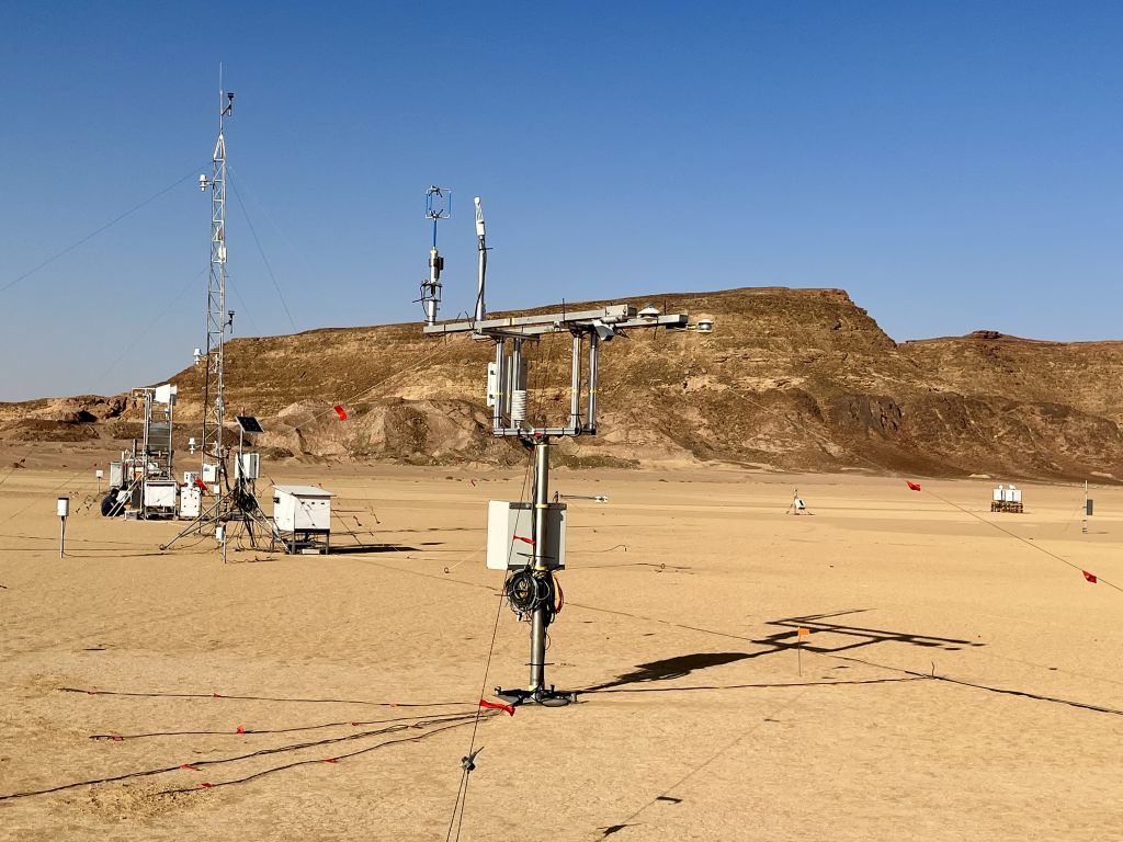
The Dead Sea region faces big water-related challenges. Among them are sea level decline, desertification, flash floods, ascending brines polluting freshwater, sinkhole development, and the repeated occurrence of earthquakes. Climate change and extensive exploitation of groundwater and surface water even aggravate the situation. These challenges can only be mastered in an interdisciplinary research effort involving all riparian countries. DESERVE and is designed as a cross-disciplinary and cooperative international project of the Helmholtz Centers KIT, GFZ, and UFZ with well-established partners of the riparian countries. Within DESERVE, the research of IMK-TRO focuses on the operation of a long-term meteorological monitoring network with several meteorological stations in combination with intensive special observation periods with KITcube, and numerical modelling. Within DESERVE KITcube was operated at a site close to MASADA, Israel with branches on the opposite side of the Dead Sea in Al Masra.
 |
 |
 |
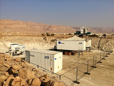 |
| Arrival of KITcube (top left) in the Desert at Masada and installation of the WindTracer HYB Doppler lidar. Radiosonde launch and KITcube main site at Masada (lower images). | |
![]() HD(CP)² (2013)
HD(CP)² (2013)
High Definition Clouds and Precipitation for advancing climate prediction - HD(CP)²
The HD(CP)² Observational Prototype Experiment (HOPE) was performed in April and May 2013. For this field campaign KITcube was installed in the vicinity of Forschungszentrum Jülich. The unique approach of the measurement campaign was the density of the measurement network: Within less than 5 km distance two other measurement systems were installed and operated the universities of Cologne and Bonn, by MPI for Meteorology as well as by TROPOS in Leipzig. Instruments at these locations were for example microwave radiometers, wind profilers as well as cloud and X-Band radars. Research goals of IMK during HOPE were on the one hand the determination of the energy balance components at the land surface, additionally considering nearby stations of the TERENO project and on the other hand the investigation of the structure of turbulence in the boundary layer. Therefore, one of the WindTracer Doppler-lidars was located about 3 km west of the main KITcube supersite together with a second energy balance station. Using Dual Doppler techniques, coherent structures were detected in the horizontal wind field. Moreover, this measurement setup allows for simultaneous observations of turbulence profiles at multiple locations. At the KITcube supersite, two additional lidar systems were installed and operated by the University of Hohenheim, measuring temperature and humidity in the boundary layer with high temporal resolution. By combining these measurements with Doppler-lidar wind measurements of KITcube, vertical profiles of turbulent fluxes can be determined. The profiles derived in this way are an important contribution for the validation of LES performed within HD(CP)².
 |
 |
 |
 |
Arrival of KITcube (top left) and installation of an energy balance station (top right). Doppler lidar WindTracer HYB and Windcube 200s at the “Wasserwerk” site next to the energy balance and turbulence tower (lower left). KITcube main site Hambach with HATPRO wind and temperature profiler, radiosonde station, 30m profile tower, energy balance and turbulence towers, WindTracer WTX and Windcube WLS8 and WLS7 Doppler lidars as well as water vapour DIAL of University of Hohenheim.
![]() HyMeX (2012)
HyMeX (2012)
Hydrological Cycle in the Mediterranean Experiment – HyMeX
Within the framework of the Hydrological cycle in Mediterranean Experiment (HyMeX) and the first special observation period (SOP 1) was conducted in autumn 2012 in the western Mediterranean. HyMeX aims to improve the understanding and quantification of the hydrological cycle and related processes in the Mediterranean with emphasis on high-impact weather events, inter-annual decadal variability and associated trends in the context of global warming. During SOP 1 KITcube was positioned at one of HyMeX's supersites on the island of Corisca. The deployment of KITcube at this position allowed to study the impact of the mountainous island on initiation and modification of isolated deep convection and provided upstream conditions for the intense precipitation events affecting continental south-eastern France and northern and central Italy. The KITcube instruments were deployed at two main sites: one at Corte in the Tavignano Valley in the center of the island and one at San Giuliano on the east coast.
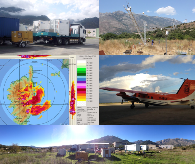
Arrival of KITcube at Corté site in central Corsica (top left) and installation of the 24 m profile tower (top left). X-Band measurements during a thunderstorm event (middle left) and reseach aircraft Dornier 128 D-IBUF (middle right). Panoramic view of the KITcube site at Corté (lower image).
 First KITcube Deployment (2010)
KITcube built up
A first set-up and measuring phase with KITcube took place between 2010 and 2011 in the palatinate village Hatzenbühl. Therby all measuring systems as well as the central data acquisition and processing were operated together the first time. This opportunity was also used to celebrate an opening ceremony with the Presidential Committee of the KIT.
 |
 |
 |
|